Back to Work

Systems

B.U.R.G.E.R Bot For Unsorted and Recyclable Garbage Effective Removal
S.U.S.H.I Surface Utilization Surveillance and Hazard Identification
T.O.A.S.T Test Operations and Aquatic Simulation Technology

Team

Supervisor Nidhal Abdulaziz
Team & Autonomy Lead Hamze Hammami
Simulation Lead Muhammad Abban
Mechanical Lead Saif Alsaad
Electrical Lead Laith Mohamed
Embedded Lead Abdul Maajid Aga
Mechanical Sameeha Misbah
Electrical Maryam Mosadegh
Electrical Aisultan Alpysbay
Mechatronics Mouayad Aldada
Scroll
B.U.R.G.E.R

What is B.U.R.G.E.R?

BURGER represents a significant advancement in autonomous surface vessel (ASV) aimed at addressing debris collection in water bodies. This ASV features a seabin-inspired collection mechanism, with a custom-built battery and smart system behaviour that enables the bot for effective debris collection even in the challenging nature of the open waters. Mechanical design led by Saif Alsaad, electrical system led by Laith Mohamed, embedded systems led by Abdul Maajid Aga.

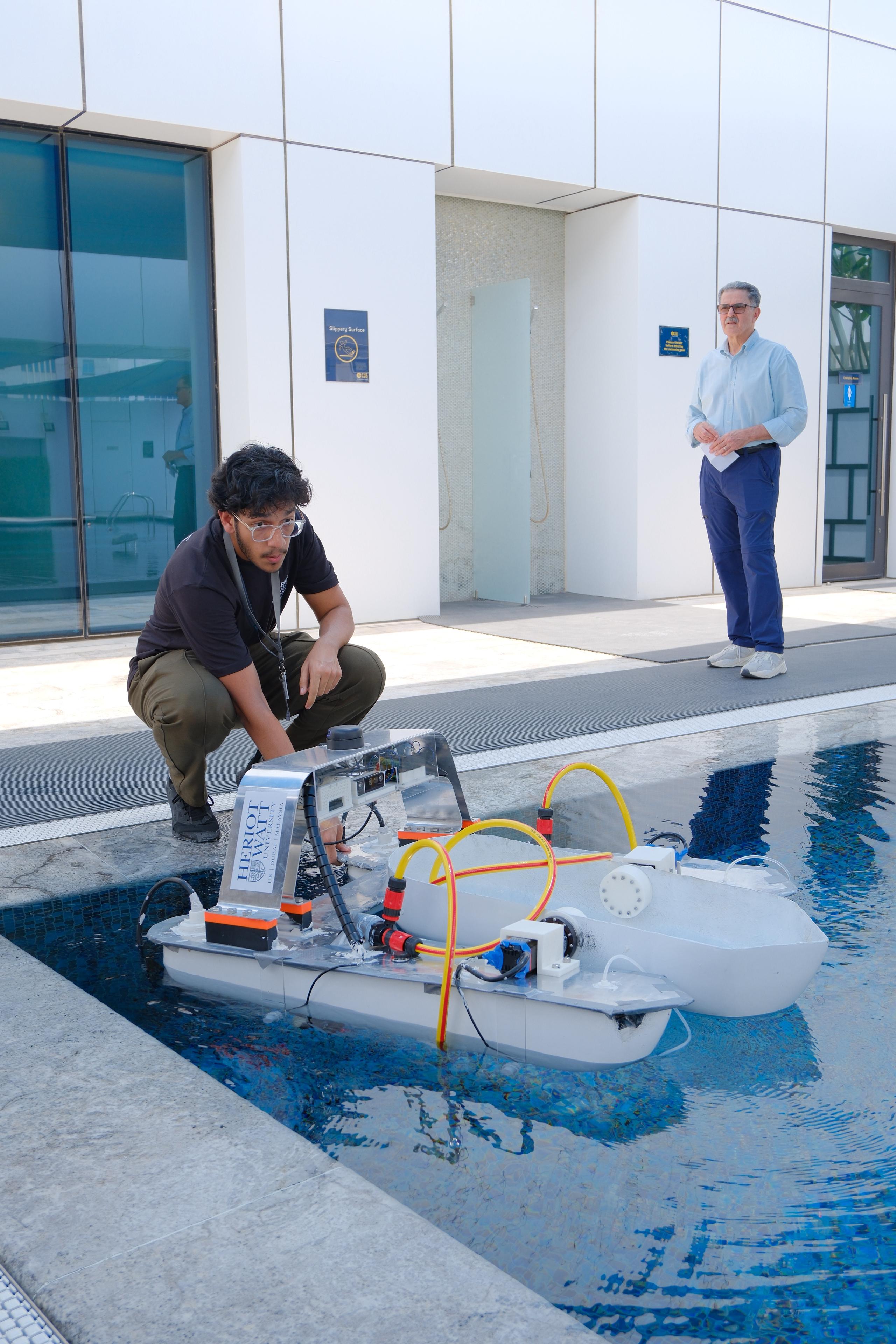
BURGER ASV in testing pool
BURGER ASV pool testing at Heriot-Watt Dubai
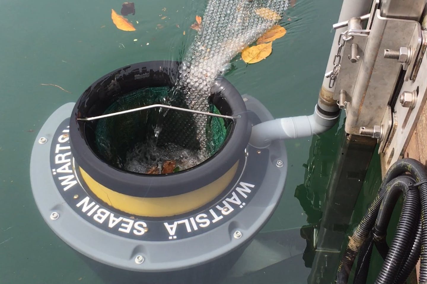
Seabin the inspiration
Seabin the inspiration behind BURGER's collection mechanism
Design

Collection Mechanism

Different collection approaches come with distinct trade-offs in storage efficiency, space usage, and mechanical complexity. Here is how BURGER's seabin-inspired mechanism compares to alternative designs.

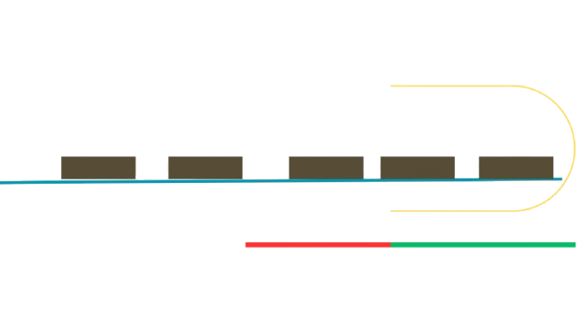
Mechanism option 1 net collection
Net Collection
  • Net can't stack trash stays floating
  • Easy and simple to implement
  • Non mechanical
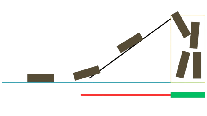
Mechanism option 2 conveyor belt
Conveyor Belt
  • Transport takes too much space
  • Most robot area wasted on conveyor belt
  • Small deep area for storage efficient
  • Mechanical
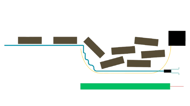
Mechanism option 3 seabin funnel (selected)
Seabin-Inspired Mechanism Selected
  • Storage efficiency
  • No transport needed
  • Needs more power
  • Mechanical
CAD

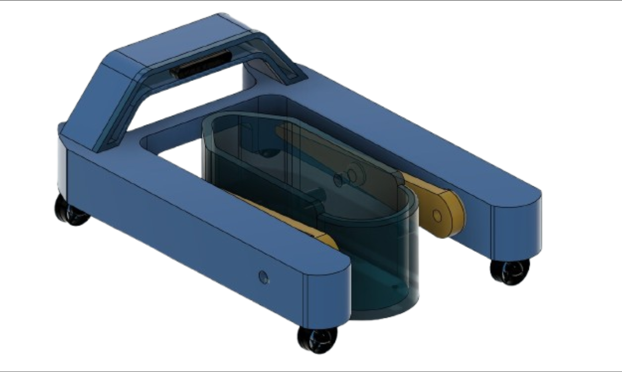
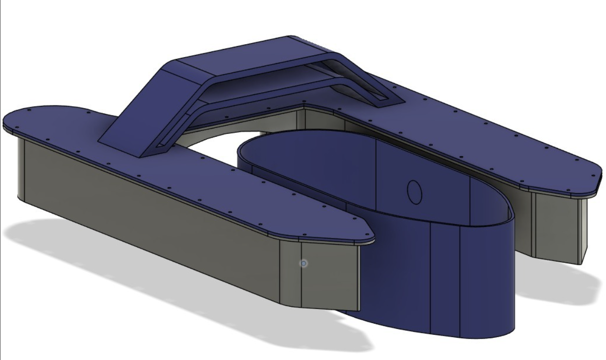
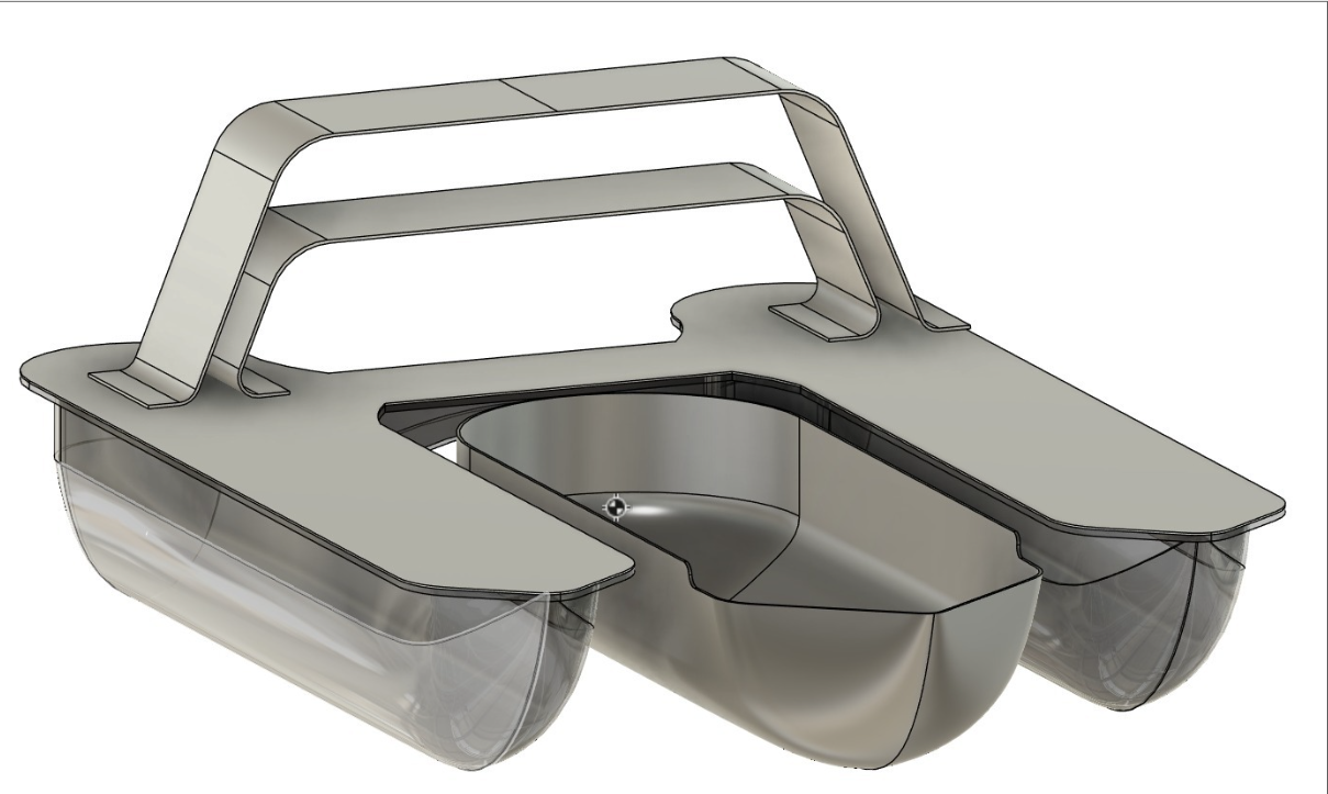
BURGER's Design Iterations

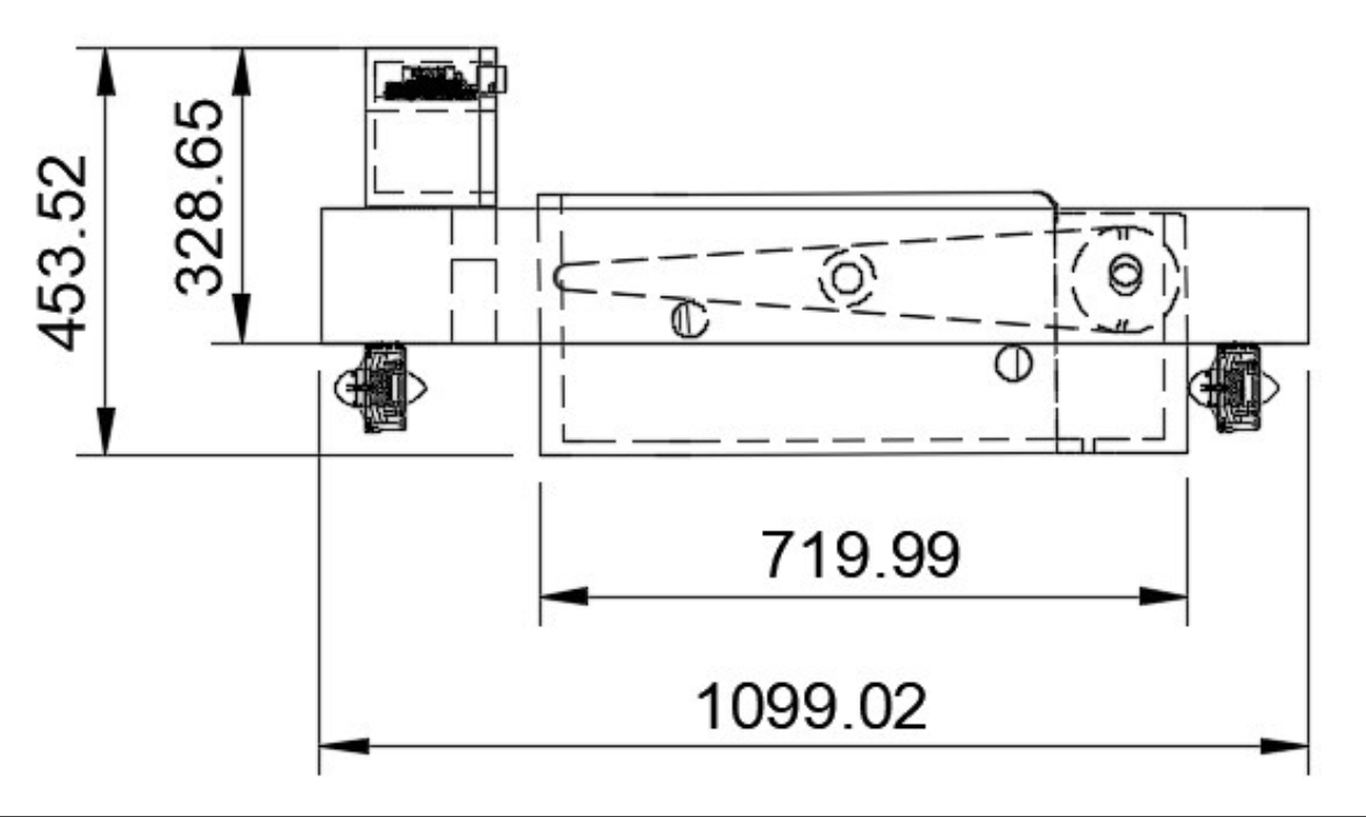
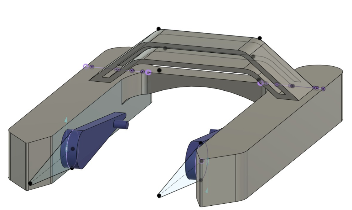
Technical dimensions side view
Dimensioned side profile
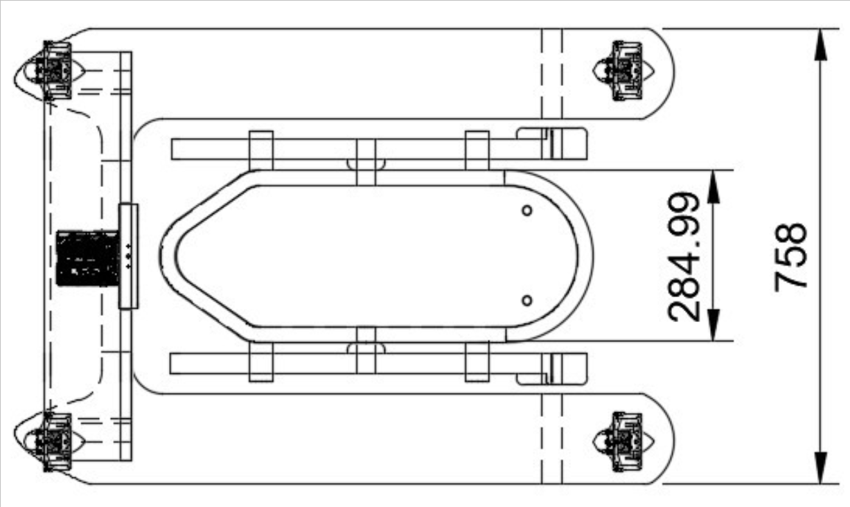
Top-down dimensioned view
Dimensioned top view
V1 render
V1
V2 render
V2
V3 render
V3
Final manufactured version
Final Version
Hardware

Electrical System

Power Supply

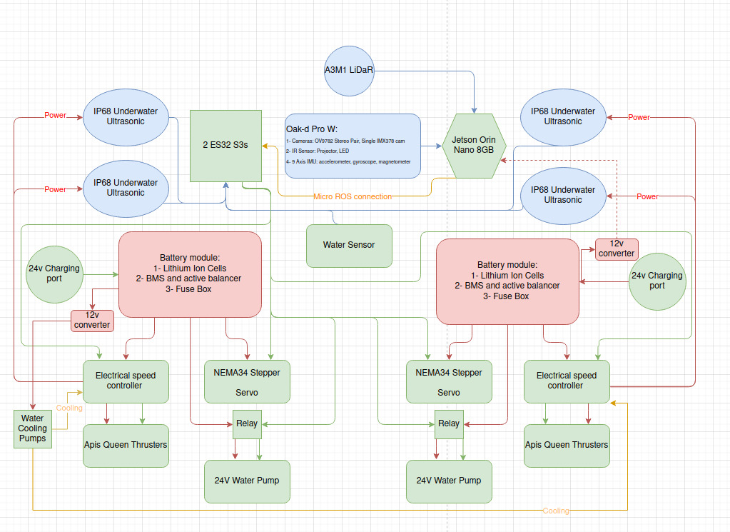
A custom-welded battery module in 7s6p arrangement with BMS systems for safety and monitoring.

Computing

Jetson Nano embedded computer used for main processing with ESP32 microcontrollers.

Actuation

Water-cooled ESC control thrusters while the servo-stepper provides precise movement of the bucket.

Sensing

OAK-D Pro W camera with stereo capabilities, 9-axis IMU, and LiDAR for environmental awareness.

BURGER full electrical schematic
Full electrical schematic showing power distribution, computing, sensors, and actuation across both hulls
S.U.S.H.I

The Pipeline

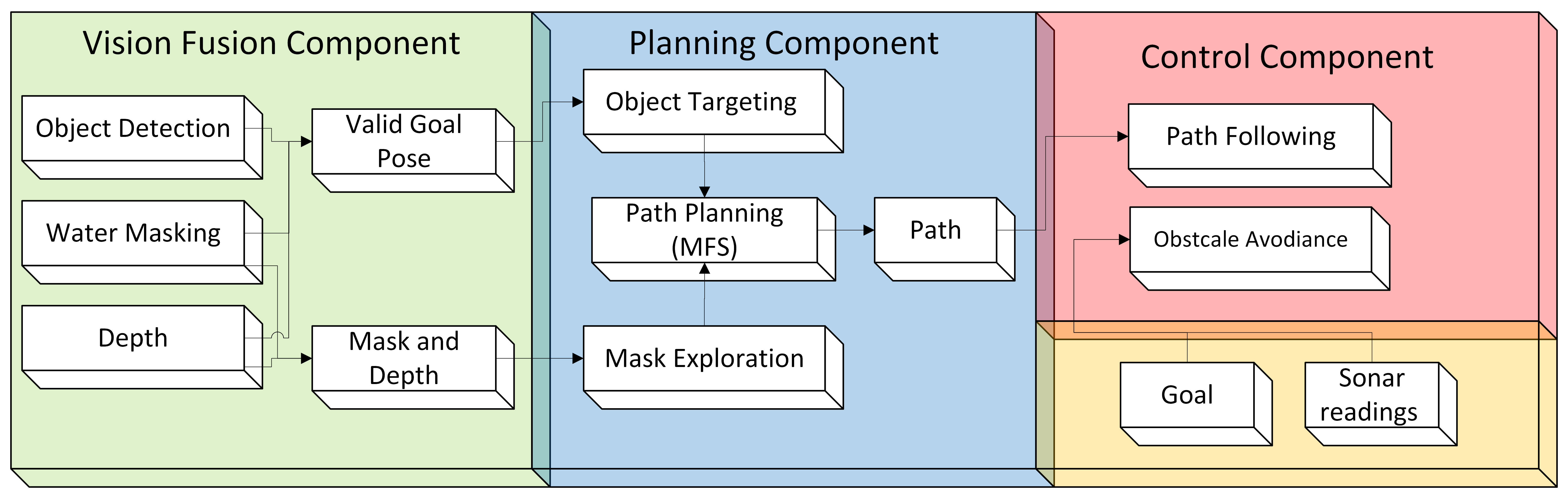
SUSHI is a vision-first navigation system for Autonomous Surface Vehicles that fuses detection, water segmentation, and monocular depth to produce camera-centric navigation grids for planning and control. The system is integrated into ROS for full robot operation, but was built mostly using PyTorch with the perception models and path planning algorithms written from scratch. It is structured around three main components: a Vision Fusion module that converts raw camera frames into spatial object data, a Planning component that guides the vessel toward targets or explores autonomously, and a Control layer that follows the planned path while handling emergency avoidance reactively. SUSHI was my contribution to the project.

System Flow
SUSHI system block diagram
SUSHI system architecture vision fusion, planning, and control components
Vision Fusion

Seeing the Water

01 · Object Detection

YOLO on Water

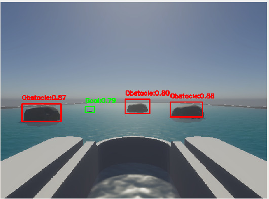
The YOLO framework was deployed for trash and obstacle detection, with the core challenge being that most available datasets provide grounded or close-up images of debris that do not generalise to floating objects seen from an ASV. A SAHI mechanism was applied to slice each frame into overlapping tiles, and the model was retrained from scratch using simulation and pool data annotated with SAM2 and a CSRT tracker, achieving a mAP@0.5 of 94.5% with an F1 score of 0.91.

YOLO detection on water
YOLO detections on water surface with confidence scores
02 · Water Masking

Knowing the Surface

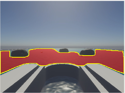
A lightweight U-Net was trained using knowledge distillation from SAM2, where the teacher model's soft logits were extracted offline and used alongside binary ground truth masks during student training. Using only 500–550 frames from 20 video sequences, the distilled model achieves over 90% accuracy on unseen data, outperforming a conventional data-driven model trained on 3,000+ images which reached 80%.

Water segmentation mask
U-Net water segmentation mask identifying navigable surface
03 · Monocular Depth

Depth Anything on Reflective Surfaces

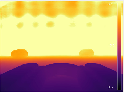
Stereo and IR-based depth sensors struggle on water due to reflections producing noisy and temporally unstable readings. Depth-Anything V2 was used instead, a monocular depth model that, as noted by its authors, benefits from synthetic training data precisely because of its advantage on transparent and reflective surfaces. Against ArUco marker ground truth it achieved a mean ARE of 0.0067 a 98.7% improvement over OAK-D and a 9.75× improvement in temporal stability.

Depth-Anything V2 on water
Depth-Anything V2 metric depth map on reflective water surface
04 · Fusion Output

Fused Vision

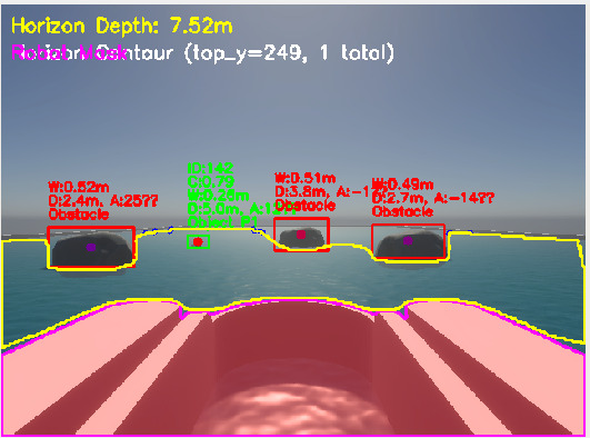
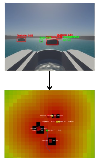
The SUSHI node fuses detection, water masking, and depth into a single navigation grid. Each detected object is validated against the water mask, assigned a unique ID, and given key attributes: confidence, bounding box width, metric distance, and camera angle. Object priority is ranked by depth, and the fusion layer filters out objects above the water surface or within the robot zone.

Vision fusion output
Vision fusion output, detections, water mask, and priority ranking fused in real time
Path Planning

Multi-Field Synthesis

MFS path planning
MFS in action, vision fusion mapped to a navigation grid with wavefront guidance field
Approach

MFS Planner

MFS addresses a core limitation of Artificial Potential Fields, local minima, by blending a reactive APF component with a global wavefront flow field. The blending coefficient γ adjusts dynamically based on clearance distance, stagnation count, and goal proximity, giving each grid cell a spatially-aware potential rather than fixed parameters. Across 15 runs, MFS achieved a 100% success rate against Classic APF's 33%, Paraboloidal's 40%, and Conical's 80%.

Behaviour Hierarchy

How the Planner Decides

Three behaviours govern planning in priority order. Target Seeking activates when debris is detected and overrides everything else. Water Exploration samples the water mask for curious navigation when no goal is visible, biasing toward denser and farther water regions. Idle clears active paths and awaits new data when no conditions are met.

Control

Path Following & Avoidance

Fuzzy Path Following

Main Controller

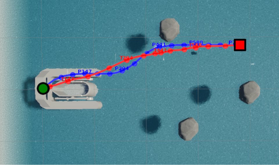
The main control loop uses a fuzzy logic controller with four inputs: distance to lookahead point, heading error, cross-track error, and obstacle proximity. Each is processed through triangular membership functions for smoother transitions than binary logic. In simulation the system achieved an average cross-track error of 0.086m and RMS error of 0.128m, with the executed trajectory differing from the planned path by only 0.12m.

Emergency Avoidance

Dynamic Window

When side sonars or horizon depth readings detect an imminent obstacle, the Dynamic Window Approach overrides path following. A window of feasible velocities is constructed, trajectories are predicted and scored for heading, clearance, and speed, and the optimal command is selected. A turn-in-place fallback activates when all forward trajectories are blocked, rotating the vessel until a clear path is found.

Path vs trajectory comparison
Path vs trajectory
Visual exploration testing
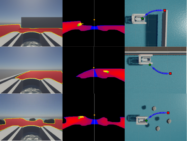
Water mask exploration across dead end, wall, and obstacle avoidance scenarios
Visual Exploration

Water-Guided Navigation

When no debris goal is detected, the system switches to a water mask exploration behaviour. Inspired by line-of-sight principles, the explorer samples candidate points within the visible water mask, biasing toward areas with higher water density and greater distance from shorelines. This drives a water-curious behaviour that keeps the vessel navigating safely without any prior map or goal. Three conditions are demonstrated: dead end escape, wall avoidance, and obstacle-dense environments, showing the system consistently choosing the safest and most open path within its visible area.

T.O.A.S.T

The Simulation

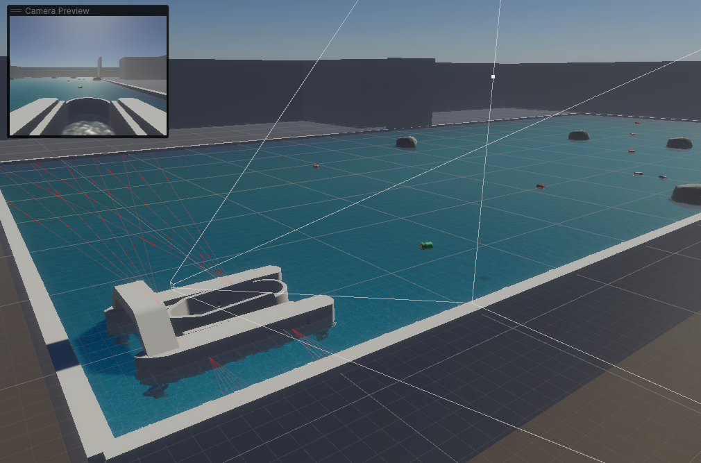
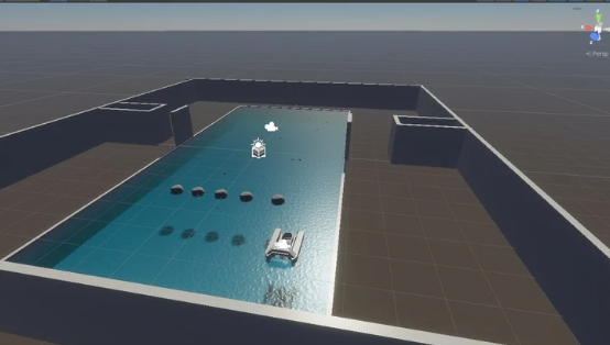
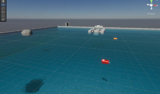
TOAST (Test Operations and Aquatic Simulation Technology) is a hardware-accelerated simulation environment for autonomous surface vehicles built on Unity. It was developed specifically for the AISV project to enable full development and validation of SUSHI before any hardware deployment. The simulation recreates a pool environment with coloured cans as collection goals and rocks as obstacles, with the robot equipped with a front-facing camera as the primary navigation sensor and four ultrasonic sensors on the sides for emergency avoidance. A LiDAR was available but deliberately excluded to demonstrate the viability of a vision-first approach.

The simulator provides a ROS2 interface for full digital twin operation, streaming sensor data and receiving thruster commands exactly as the real vessel would. Scenarios are configurable and saveable as JSON files, with obstacles randomisable in position and orientation for varied data collection. Two buoyancy modes are implemented, one fully physics-based using hydrodynamic equations and one kinematic for lightweight simulation. TOAST was the primary environment for developing and benchmarking all SUSHI components. Led by Muhammad Abban.

TOAST simulation with camera preview
Simulation with camera preview and sensor rays
TOAST open water configuration
Open water world configuration
TOAST pool environment
Pool environment with goals and obstacles